Smart Deployment
What is the best location for your future activities?
Geospatial data provides crucial information to determine the ideal location for your future operations. AI can process these huge volumes of data to fuel decision-making about your future facilities.
Functionalities
-
Location of zones and exploitation of data sources
Identify the most suitable areas for your development projects in real-time from multiple data sources. Reduce the search area for potential sites.


 Satellite images, information on electrical networks, gas networks, road traffic, parking areas, etc.
 -
Use your feedback
 Improve Smart Deployment performance by integrating corrected and updated data.
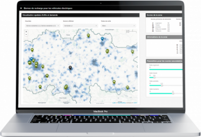
Supply/demand ratio and constraints management
Using geospatial data, AI determines supply and demand scores based on rules you define.

SMART DEPLOYMENT IN ACTION
-
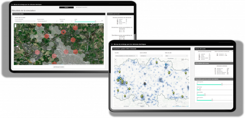
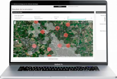
ELECTRIC CHARGING STATIONS NETWORK
Smart Deployment has helped optimize the implementation of electric vehicle charging devices.
The company went from 7,400 potential locations to about 250 target locations in Belgium (-96.6%) and from 8,726 to 250 in Quebec City (-97.1%).
The reduction in manual work allows the teams to focus on higher value-added tasks! -
CONSTRUCTION
One of our construction customers uses satellite imagery and Smart Deployment's overlay visualization module (traffic networks, parking spaces, electrical networks, gas pipes, etc.).
This allows him to analyze the environment in which it operates and to explore the data at an extremely precise scale to optimize its activity.